Map of Cruise to the Radio Forts in the Thames Estuary


Radio Forts HOME PAGE

>>>

Red Sands photos .... in 2003

>>>

Shivering Sands photos .... in 2003

>>>

Knock John photo .... in 2003

>>>

SITEMAP LINKS

>>>

"Waverley Excursions" trips to the Thames Estuary and the FORTS and much more!

>>>

Bob Le-roi : Thames Estuary cruises including trips to the FORTS


image
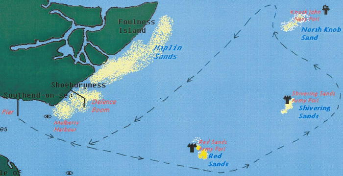
Map detailing actual cruise route for trip on 28th September 2003 from Southend Pier to some of the Maunsell Sea Forts in the Thames Estuary used by various Pirate Radio stations in the 1960's.Map adapted from the "GNOMETECH" website which has info about River Thames sites including the forts used by the offshore radio stations...

>>>

Red Sands and Shivering Sands on 2nd October 2005 ... click here!
image
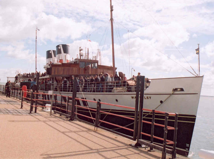
Radio Forts cruise - PS Waverley at Southend Pier 2nd October 2005

>>>

image
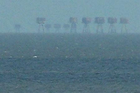
View of Red Sands Fort with some of the Shivering Sands towers in the background as seen from Minster on the Isle of Sheppey in 2005. (Photo courtesy of Graham Bartlett).

>>>

SITE MAP LINKS to all pages on "Radio Forts" website ... CLICK HERE!

>>>

Radio Forts HOME PAGE

>>>

Recent photos of the Thames Estuary Maunsell Sea Forts on the two website LINKS below. Photos taken on 3rd June 2006.

>>>

Hywel Williams "Thames Estuary Maunsell Forts" site. Five pages of excellent photos taken on his recent "Bayblast" RHIB excursion ...

>>>

James Salter's excellent Photo Gallery and video of the Thames Estuary forts taken on the same "Bayblast" RHIB trip ...

>>>

... More links to other sites with recent Maunsell Sea Fort photos ...

>>>

Thames Estuary boat trip on 15th April 2006 ... Very moody photos of the sea forts ...

>>>

Jonathan Stewart's gallery of photos of the forts taken on 9th April 2006 ... Lots of pics!

>>>

image
Any comments or contributions please contact us.